Westward Wanderlust Day 12
Mount Rainier National Park, WA
July 21st, 2012
The morning was saturated with the rich scent of burnt wood, remnants of the cedar logs that had smoldered late into the night. The cozy fireplace had made the atmosphere in Oak Cabin complete. We probably stayed up later than we needed to, but it was worth it. In the morning light, I was able to take a few shots of the moss-covered Mount Haven. It looked a little less ominous than it did in last night’s fog.


Oak Cabin, Mount Haven

Mossy front office


Who loves moss? I do!
We started the morning with Foster the People Torches album.
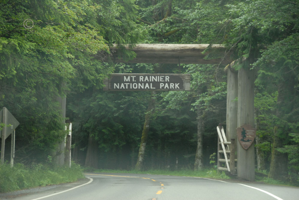
As we entered the boundary of Mount Rainier National Park once again, and hoped that today we would be able to see its namesake. The morning was already draped with a thin veil fog, and the further we drove, the less promising the sky looked.


The clouds seemed to reach for each fragment of vibrant blue sky, then close tightly around it. Huge, greedy fists, snatching and grabbing each brilliant shard, then squeezing it until only small blue splinters glimmered elsewhere, then faded away.


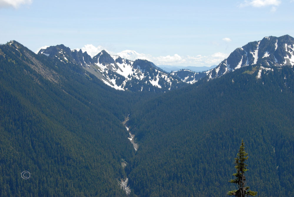
Would we see Mt. Rainier? We headed to Paradise Valley and were faced with this following view of Mt Rainier:

Are you sure there’s a mountain back there?
Despite the cloudy curtain before us, the promising blue sky continued to diligently peeking through. D and I had faith that if we stuck around, we would indeed see what we had patiently waited for. In the mean time, I explored another feature that this park is famous for … wildflowers.

Wild Lupine – Lupinus perennis

Wild Lupine – Lupinus perennis


Avalanche Lily – Erythronium montanum

Ooo! Interactive park signage!
We we ready to hike up the mountain, but not without seeing it first. Of course, not everyone comes to Mount Rainier to hike…

Not there to “get out in nature”.
As the clouds float silently and swiftly across the sky, we watched intently for any view of the mountain.

Hmmm…

Wait for it…

Nope.

Not yet.

Seriously?

Any minute now.

Come on.

You can do it!

Almost there!

THAT’S what I’m talking about!

YAY!!!
Mount Rainier! At last! Anxious to do a bit of walking after the waiting, we hiked the Alta Vista and Glacier Vista Trail.

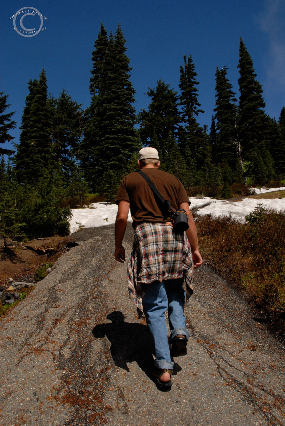
D on the trail.


The snow was wet, packy, and the quite slippery. Perfect snowball snow! This, of course, led to a snowball fight on the mountainside, followed by a mini snow friend.


Me and D mountainside.


Photo by D. R. J.
The steps leading to the trail are appropriately emblazoned with a quote from 1889 by the conservationist and the original advocate of the National Parks, John Muir; “the most luxuriant and the most extravagantly beautiful of all the alpine gardens I ever beheld in all my mountain-top wanderings”. As we hiked, I too was amazed by the wildflowers that grew so heartily beside the snow.

Indian Paintbrush – Castilleja occinea

Western Anemone, Flower Stage- Anemone occidentalis


Avalanche Lily – Erythronium montanum

Pearly Everlasting – Anaphalis margaitacea

As we left, the clouds covered the mountain again. We continued through the park toward Sunbeam Creek.


Hoary Marmot – Marmota caligata

Hoary Marmot – Marmota caligata


Sunbeam Creek
The road ‘round Rainier heads South from Paradise Valley, then turns north, curving around the base of the mountain.

Thanks for the warning.


We met up with Mather Memorial Parkway, then to White River area. We were welcomed to the White River campground the the following gentle warning:

We had read something about a log bridge over the White River, (probably in Mike’s book) so we decided to check it out. It was 66 degrees and the sun was beginning to win out over the clouds as we walked down to the White River. The log bridge was literally that; ONE log that bridged the width of the White River.

Balancing over the White River! Photo by D. R. J.
The name “White River” must have come from the white froth of the colliding rapids. The rest of the water is so full of sand and silt that it looked like chocolate milk rushing violently over the rocks. As we stepped conscientiously onto the log, we could feel the river moving beneath us. The power of the current shook the crude bridge with relentless force and intensity. Cuts from saws and axes stacked the length of the sun-bleached wood, and I took of my flip-flops, wary of my footing in such stumble-provoking attire. Despite the risk of a decidedly dangerous plunge into the freezing glacial water, we were incredibly entertained by this opportunity experience the might and muscle of the mighty White River.
This was a moment that merited a short video:
We continued on to Sunrise Point, elevation 6,100 feet.


Sunrise Point

Sunrise Point


Our goal was to make it to the summit of Sunrise Road, 6,400 feet, for one more look at the peak of Mount Rainier. But once again, the clouds were moving quickly toward the mountain. It was a race to Rainier! Would we beat the clouds to the top?


D speeding up Sunrise Road.
Yep! Made it! Just barely though!


Clouds moving in again!


Sunrise Ranger Station
Now that we had actually seen main attraction, multiple times even, we descended Mount Rainier and began consulting our bundle of atlases to map the path to our next destination: Mount St. Helen’s.

Yes, you read that right. A map. We have been charting our course the old school way: paper maps and atlases. The only consultation of digital navigation has been via cell phone to search locations of breweries and restarants, or negotiate our way through a large city, which has not always proved to be a fruitful means of routing; I used my phone to direct D through Seattle, and we know how well that worked out… Actual, physical maps have obliged us adequately. That and of course, the helpful road signs.

Now, does the above road make you think, “Hey, what a great place to ride a bike!” Me neither. However, there is a considerable and committed band of bikers we have seen speeding down many of the steepest roads through the National Park system that would argue otherwise…like this guy.

Dude, you are hard core!
Not for me, thank you.
We arrived at Mount St Helens just before sunset, around 8:00 pm. Since it was well past peak tourist time, we seemed to have the place to ourselves. There was just enough sunlight left to see the giant concave crest of the volcano.

Mt. St. Helens

The shadows morphed over the landscape as the horizon grew darker and the remaining sunlight turned golden.


Wow! What a hole!


We ventured to view as many areas around the volcano as we could before it was too dark to see anything.


The Shadow knows!

Finally! Signage that address the animals! 🙂
As the last bits of daylight began to disappear behind the shoulder of the Earth, we continued on our way.


Mt. St. Helens


We glided past thick stands of Western White Pines, which we referred to a “digital trees”. You can see why:

The night was taking command, so we continued on our path.

D in the dark.
Despite the questionable venture through Seattle a few days ago, we decided to take a chance with Portland. We arrived at Hopworks Urban Brewery before sometime before midnight and enjoyed some a unique cyclist-inspired décor, delicious Organic Hopworks IPAs, and awesome calzones; amusingly, D ordered the Hunter (filled with meat) and I ordered the Gatherer (filled with veggies). Yum!

Mmmm…beer.

Guess what’s inside??

Ta da!

Hopworks Urban Brewery, Portland, OR

“The Gatherer” Calzone. Super tasty.
Now to find a place to sleep and then off to Crater Lake in the morning!
Westward Wanderlust Soundtrack Day 12-
Entering Mount Rainier –Foster the People Torches
Sunbeam Creek – Fruit Bats “Feather Bed”, fun. “Some Nights”
Sunrise Road North – “Shake it Out” Florence and the Machine
White River – Beck Odelay
Driving to Mt. St Helen’s – Natalie Merchant Tigerlily, Tori Amos, The Word (Luther Dickinson, Robert Randolph, John Medeski Chris Chew, Cody Dickinson) The Word
Awesome. I haven’t had much time to “slow down” in a while… well, years, I suppose. I am holed up in the cozy confines of the shop re-reading everything. It’s like going on vacation… just me and my mind… and we haven’t seen much of each other lately…
Thanks Ava! Glad we could reconnect you with yourself for a bit. I know the feeling. I can’t wait to come see to new shop. I miss you. Let’s chat soon.
Your pictures are wonderful!!!!
Thank you!
Hi Adrienne and Derrick,
I love reading and viewing your trip thru your lense! Someone else commented it’s like going on vacation from the comfort of your home, and I agree……delightful descriptions and beautiful imagery. Thank you for keeping me in the loop! Lois
Thanks Lois! So glad you are enjoying it.
Hiee Derrick and Adi! Grrrrreeeat pics!! Thanks for sharing with us!!!
Love you both! Love, Reag and J
Thanks kids! 🙂