Westward Wanderlust Day 19
Death Valley National Park, CA
July 28th, 2012
We woke to an intensely bright morning light and a cloudless blue sky. The sparkling spectacle of the Death Valley night had long since been scorched by the merciless desert sun and we quickly became acquainted with the true nature of the beast. It was 8:00am and 103 degrees.

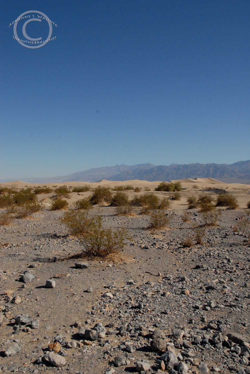
Waking up in Death Valley

Note the rocks on the corners to keep us from blowing away…
Bright, hot, and dry, waking up in Death Valley is to wake up thirsty. We climbed out of the tent and retrieved our water from the car. We had come to our voyage armed with a variety of reusable water vessels that we routinely filled when needed. The rate at which we had passed through our last few destinations had resulted in our possessing water from three distinct locations. We drank all three, paying close attention to the difference in taste. My Camelback was filled with water from Yosemite, but it unfortunately tasted like the plastic bladder in my Camelback. One of our Sigg bottles however was filled with water from Sequoia. D observed a heavy taste of tannins, a clear effect of the abundance of redwoods, sequoias, and other tannin-saturated plants. We then drank water from the spigot at our current campsite, (which by the way, is labeled as “radiator water” to cool your overheated vehicle on one of the park maps). The Death Valley water was very warm tasted like hot granite, tinny and almost metallic. We drank to satisfy our parched throats and then made some breakfast.

Emigrant Campground
In all my life, I never would have predicted waking up in Death Valley on my 30th birthday. Though I wouldn’t have expected a hot, windy night in Death Valley to be one of our favorites nights of our trip so far either. But it is really impossible to evaluate and compare the variety of incredible places we have seen since we began this trip 19 days ago. Everyday has been one amazing encounter after another, seeing first-hand some of America’s most fantastic natural wonders. It may sound like a bizarre place to spend your birthday, but at this moment, I was exactly where I wanted to be; deep in a road trip with my partner, experiencing one of the most extreme places in the country.

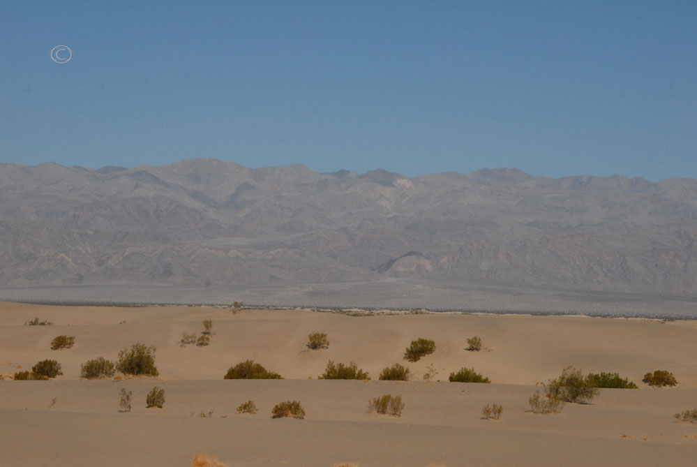
Emigrant Campground view of the desert

Nearby cacti

Nearby cacti

We packed up our gear, and headed toward Stovepipe Wells Village.

Hwy 190 Death Valley
The ranger station where we would have gotten a stamp was not open yet, so we stopped in the gift shop were D had me pick out a birthday memento. I chose a necklace with a carved wooden skull. I have a thing for skulls and I thought it was a very fitting image for Death Valley.
Next, it was on to the Mesquite Flat Sand Dunes. As we pulled into the parking lot, we saw two men in bicycling attire. One man looked to be preparing to ride, the other preparing to follow in a car. They were reviewing safety plans and exchanging words of encouragement. The path ahead of them would span the lowest and highest points in the lower 48 states. Starting at the Badwater Basin in Death Valley, 282 feet below sea level, the ride would take them to the top of Mount Whitney, an altitude of 14,491 feet! It seemed they must have started at Badwater earlier in the morning, and were about to begin the next leg of their extreme journey. Amazed at their fortitude, we watched as the cyclist mounted his bicycle and headed west to complete the last 84 miles of the total 130 miles between points. All I can say is “Wow”.
We walked toward the Mesquite Flat and began to ascend the dunes. The dunes rise nearly 100 feet from Mesquite Flat, rippling and curving like tawny, immobilized waves.

Mesquite Dunes
Mesquite Flats
The morning is a good time to visit the dunes, not only because of the probability that the desert heat has yet to reach full force, but morning on the dunes is also a great time to spot tracks of nocturnal wildlife in the sand.


D pointing out some tracks


Shade!
It’s amazing when you think about the fact that these dunes are composed of an immeasurable amount of tiny stones. As we walked, the tiny stones slid and rushed beneath our feet, our weight constantly changing the shape and silhouette of the mounded sand.

Mesquite Dunes

Mesquite Dunes


The dunes are constantly being transformed by the wind as well; I would imagine that the after last night’s wind, today’s dune peaks are very different from yesterday’s. This made me think about how exceedingly difficult it must be to navigate a desert. Even in the short hike we took, I soon realized how very tricky it was. Once you get on the other side of a dune, you think, oh, I’ll just walk straight and turn around and walk back the same way. But as soon as you turn around, the dune you just crossed looks different. Your footprints blend in with yesterday’s footprints and waves and divots in the sand. D had to right me at least twice to make sure we were headed in the correct direction.

Mesquite Dunes

The size of the dunes is deceiving, as is the effort one may need to exert to climb them.

D at the base of a dune.

Me at the crest of a dune.(Photo by D. R. J.)

Yep. A lot bigger than they look. (Photo by D. R.J.)
As we scaled the dunes, we watched tiny lizards scuttle across the sand from shade patch to shade patch.

The sun climbed higher in the sapphire desert sky, casting long dark shadows on the hot white sand.


The Death Valley Sun

Mesquite Dunes
Mesquite Dunes
Whether it was wind or weight moving the sand, the tiniest push could send billions of grains tumbling down the dunes. At the top of one of the dunes, we spotted a small piece of sandstone and watched this high-speed erosion happen on a miniature scale.


Mesquite Dunes (Photo by D. R. J.)

Mesquite Dunes (Photo by D. R. J.)

Mesquite Dunes (Photo by D. R. J.)

Mesquite Dunes (Photo by D. R. J.)

Mesquite Dunes (Photo by D. R. J.)

Mesquite Dunes (Photo by D. R. J.)

It was 9:20 and 93 degrees when we left Mesquite Dunes and headed toward Furnace Creek. I had been looking forward to the soundtrack I had chosen for our drive through the Death Valley, Jim Morrison’s An American Prayer. We listened to Jim’s mysterious, primal poetry as we resumed our passage through the desert; “Awake, Shake dreams from your hair / My pretty child, my sweet one / Choose the day and choose the sign of your day / The day’s divinity / First thing you see… / …Enter the hot dream / Come with us / Everything is broken up and dances.”


Next, we stopped at the Salt Creek Interpretive Trail. More than 200 feet below sea level, Salt Creek is a perennial stream that is home to the endangered pupfish. However, winter and spring is when you are more likely to actually see these creatures, as well as any water. In the height of summer, the water retreats to the source of the spring, leaving behind a crisp, brittle creek bed.

Salt Creek Trail

Salt Creek Bed

Salt Creek Bed

Salt Creek Trail
Though we did not spot a pupfish, the trail was not completely devoid of life.

How anything can thrive in this heat is amazing to me, but the plants and animals that live and grow in Death Valley have adapted to flourish here.

Desert Holly (Atriplex hymenelytra)
The silver-white leaves of the Desert Holly reflect the intense sunlight and curl their edges inward to reduce exposure to the extreme elements. This plant is pollinated by wind instead of insects, growing and flowering in the winter and remaining dormant during hot summers.

Zebra-tailed lizard (callisaurus draconoides)

Zebra-tailed lizard (callisaurus draconoides)
The Zebra Tailed Lizard is very heat tolerant. While most other lizards must seek shade during the day, this hearty fellow scurries about the sand into midday. The intensity of their coloration can also change with the temperature, becoming lighter as the temperature rises.

Pickelweed (Salicornia virginica)
Pickleweed can grow in a soil salinity of up to 6%, making it an excellent resident for the Salt Creek neighborhood. The salt is filtered first by the roots of the plant, then pumped to storage cells at the end of the bumpy “pickle-like” stalks. When the storage cells cannot hold anymore salt, the cell breaks down, the tips turn red, fall off the plant, and the next batch of cells take over pumping and storing salt.
When we left Salt Creek, it was 10:05 am and 100 degrees. This knowledge made our next sight unbelievable:
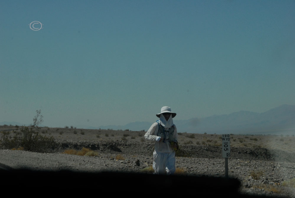
Running?! Seriously?!
Again, WOW.
We continued south on the sizzling stretch of asphalt that carves through the park, Hwy 190. Then we curved along a one-way dirt road through the yellow and orange badlands of Mustard Canyon.

Mustard Canyons

Mustard Canyons

Mustard Canyons

Mustard Canyons
Our next stop was the Harmony Borax Works Interpretive Trail. It was 10:30 and the thermometer had risen to 105 degrees. We hiked up the trail to view the historic mining operation.

Before Death Valley became a National Park, mining was the focus of the area. The most lucrative ore found here was a substance called borax. Also known as sodium borate, borax is a mineral used to make soap, toothpaste, household cleaners, and is also used to make certain types of glassware. When borax was found near Furnace Creek Ranch in 1881, the Harmony Borax Plant was built.

Harmony Borax Works
The white mineral was raked from the desert floor, then hauled out 10 tons at a time by a team of mules. Borax is best known as “20-Mule Team Borax”, a moniker encouraged by Stephen Mather as a way to increase sales, which also reflected the process of removal. Stephen Mather, who amassed considerable wealth with his borax interests, eventually became the first director National Park Service. His financial achievements were paramount in preserving many natural marvels, including Death Valley.

20 Mule Team Cart

I’m not sure if I’d trust those breaks…

Former Borax Field

Harmony Borax Works

Borax miner cabin
We continued on to Furnace Creek and stopped in the visitor center for a passport stamp.

We filled out water bottles and encountered a unique bit of park signage in the restrooms.

Good to know!
(Photo by D. R. J.)
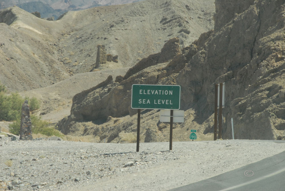
As we drove towards Zabriskie Point, the severity of the Death Valley landscape as well as the isolation of our location was emphasized by the road signs.


The some of the colorful eroded badlands of Death Valley seemed much sharper than the Badlands of South Dakota, more jagged and razor-like.


We reached Zabriskie Point and hiked the steep paved trail to the viewing area. A popular place to visit at sunrise and sunset, Zabriskie Point is a labyrinth of vibrant badlands. The layers of sediment create ribbons of color that weave a fantastic quilt that seems swell and wave beneath the blinding sun.

Zabriskie Point

Zabriskie Point

Zabriskie Point
Dramatic bands of ocher, beige, russet, auburn, and chocolate surged across the erosional landscape, the height of the midday sun forbidding any shadow or shade from altering the true hue of the ancient sand and soil deposits.

Zabriskie Point

Zabriskie Point

Zabriskie Point

Zabriskie Point (Photo by D. R. J.)

Zabriskie Point

Zabriskie Point (Photo by D. R. J.)
The weathering as well as the previous presence of thermal waters is partly responsible for the variety of colors here. All in all, it is a magnificent display of the forces of time, the power of nature, and the unexpected beauty of the driest, hottest, and lowest National Park.

Zabriskie Point

Zabriskie Point (Photo By. D. R. J.)
It was high noon and 101 degrees when we began to follow Hwy 190 out of the park.


Thanks Death Valley!
Our next ambition was to circumnavigate Las Vegas on our way to our subsequent objective, Zion National Park.
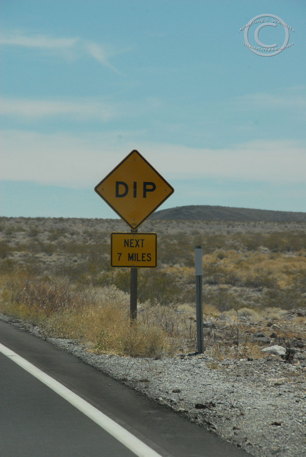
That’s a big dip!

We turned north on Hwy 373, then east on NV Hwy 95. It was 103 degrees when we crossed the state line.

Not long after we entered Nevada, we stopped for gas at the most bizarre gas station complex I have encountered.


This Gas Station / Cathouse / Bunny Ranch / Area 51 fueling depot was home to the “Remodeling for your Pleasure” Cathouse, the Area 51 Alien Bar and Grill, and the most ridiculous collection of souvenirs I have ever seen. While D pumped the gas, I went in to use the facilities and was greeted by a diverse array of Bunny Ranch and Area 51 themed keepsakes. From Backyard Bunny Hot Sauce adorned with scantily clad ladies, to green alien-covered shot glasses, hats, snacks, and aprons, to Cathouse lighters and Ron Jeremy t-shirts, I couldn’t help but chuckle as I perused the isles. I bought some sexy hot sauce for a friend and we continued on our way.
We flew down Hwy 95 toward Las Vegas.

Ah, the open road!


As we arrived outside of Vegas, there was a long line of cars backed up near on off ramp and a slow-moving police cruiser at the head of the line. After a painstakingly slow approach, we saw the cause of the delay: renegade lawn furniture!

Oh, the humanity!
We jumped on Hwy 15 just after Vegas and headed toward Utah. We switched drivers near Moapa, and I took over the wheel. According to our calculations, we would soon cross the state line into Utah and keep going until we hit Zion. The next sign however surprised us.

What?!
We pulled out the atlas. Sure enough, Hwy 15 takes you through the very edge of the northwest corner of Arizona. I maneuvered through the beautiful painted cliffs that enclosed the highway, sometimes at 80 mph just to keep up with traffic. As I accelerated through the turns, the slope of the road became very sheer. I cautiously rode the steep grades and sharp curves all the way to Utah, while D snapped some shots of the rock face flanking the highway.

Well, not 80 mph here, thank goodness. (Photo by D. R. J.)

Photo by D. R. J.

Photo by D. R. J.

Photo by D. R. J.

Photo by D. R. J.

OK, Arizona. Just cut right through the rock then. (Photo by D. R. J.)

Yikes. (Photo by D. R. J.)

So cool. (Photo by D. R. J.)
And before we knew it, we were out of Arizona.

Photo by D. R. J.
Being in four states on one day does not happen too often, let alone four states on your birthday. We also crossed two times zones and ascended from more than 200 feet below sea level. I would undoubtedly classify my 30th birthday a great success. I was looking forward to topping it off with a long shower, a hot meal, a cold beer, and a glimpse of our next National Park.

First glimpse of Zion
We turned off the freeway St. George checked into the Majestic View in Springdale, just outside of Zion. After an amazing shower, we enjoyed dinner at Arkansas Al’s, complemented by a few Zion Brewing Company Hop Valley IPAs.

Our lovely room…

with a porch!
From the porch outside our hotel room, we had a fabulous view of the vibrant cliffs of Zion. The rock walls displayed magnificent flashes of scarlet, crimson, burgundy, rose, taupe, and ginger. Tufts of underbrush and trees burst from the richly colored cliffs, the arborous explosions of green and grey demonstrating the life-giving abilities of this desert wilderness.

Cliffs of Zion

Cliffs of Zion
We watched bats zig-zag through the air as the sun began to set. The glow of the receding day changed hue of the cliffs to warm fuchsias, pinks, and golds. Bright carrot oranges and sunflower yellows radiated from the rocks, and the rim of the blazing cliffs stood out against the evening sky like hot iron on an anvil.

Cliffs of Zion at sunset

Cliffs of Zion at sunset

Cliffs of Zion at sunset

Cliffs of Zion at sunset
The brilliant palette of color was soon shadowed by nightfall, but the colors then seemed to escape from the rock and spread into the sky. Luminous pinks and oranges unfolded into the periwinkle skies, reaching soft cloud fingers across the pale skin of the evening. We watched as twilight blushed in the presence of this beautiful desert queen, this boldly painted lady of the southwestern skies.

Twilight at Zion

Twilight at Zion

Twilight at Zion
I was reminded of a line of Jim Morrison’s poetry that had accompanied us in Death Valley
“…Give of color / a hundred hues / a rich Mandala / for me and you…”

D and I watched as the day came to a close the night took command. A good nights sleep awaited us as we mused over tomorrow’s adventures. We were going to need all the rest we could get if we were going to claim our prize: reaching the 5,785 foot peak of Angel’s Landing.
Westward Wanderlust Soundtrack Day 19
Driving through Death Valley: Jim Morrison and The Doors – An American Prayer
Leaving the Cat House/Area 51 Gas Station: Oasis – “F**kin’ in the Bushes”